Merk: Imray
Model: YOT0450
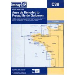
On this 2017 edition the latest depth surveys have been applied along with general updating throughout. Harbour developments at Concarneau are included...
€31,50
Excl. BTW:€26,03
Merk: Imray
Model: YOT0460
2017 Editon- Fully modernised and updated throughout...
€31,50
Excl. BTW:€26,03
Merk: Imray
Model: YOT0461
For this 2014 edition, the chart has been completely revised and updated throughout...
€31,50
Excl. BTW:€26,03
Merk: Imray
Model: YOT0462
2018 Edition updated throughout, with fully updated lights and buoyage in Rade de la Pallice, Pertuis de Maumusson and the approaches to La Gironde. In addition, a new plan of Port MÚdoc has been added to the chart...
€31,50
Excl. BTW:€26,03
Merk: Imray
Model: YOT0463
On this 2017 edition a new plan of Laredo Marina has been added- the plan of La Gironde and La Garonne on the back of the chart has been improved, and the sketch plan of Capbreton has been replaced with a WGS84 - compatible plan. Harbour developments are shown at Bilbao, and the latest depths have b..
€31,50
Excl. BTW:€26,03
Merk: Imray
Model: YOT0633
For this 2015 edition the chart has been fully updated throughout with new depth surveys where necessary. Harbour developments are also shown at NazarÚ, Sesimbra and Sines...
€31,50
Excl. BTW:€26,03
Merk: Imray
Model: YOT0120
For this 2017 edition the latest depths have been applied throughout - in particular at Start Bay, R. Dart entrance, Tor Bay, Exmouth, The Shambles and Weymouth Bay. Positional inaccuracies have also been corrected on the Torquay Harbour plan.PRINT AUGUST 2018..
€31,50
Excl. BTW:€26,03
Merk: Imray
Model: YOT0130
Salcombe (1:15 000) Plymouth Sound (1:50 000) Looe (1:50 000) Polperro Harbour (1:3500) Fowey Harbour and Approaches (1:10 000) Charlestown Harbour (1:5000) Mevagissey Harbour (1:3500) Falmouth Harbour (1:20 000) For this 2015 edition the latest depth surveys have been applied th..
€31,50
Excl. BTW:€26,03
Merk: Imray
Model: YOT0140
Newquay Bay (1:10 000) Saint Ives (1:15 000) St Mary's Road (1:25 000) Hugh Town (1:10 000) Mousehole (1:5000) Newlyn Harbour (1:12 000) Penzance (1:12 000) Saint Michael's Mount (1:12 500) Porthleven (1:5000) Mullion Cove (1:7500) For this 2014 edition the chart has been ful..
€31,50
Excl. BTW:€26,03
Merk: Imray
Model: YOT0749
Op deze editie de magnetische variatiecurves zijn bijgewerkt met 2021-gegevens. Onder nieuwe royaltyvoorwaarden heeft de DGA (Danish Geodata Agency) het onhaalbaar gemaakt om hun auteursrechtelijk beschermde gegevens te reproduceren. Alle DGA-gegevens zijn uit deze grafiek verwijderd. Er zijn overal..
€31,50
Excl. BTW:€26,03
Merk: Imray
Model: YOT0150
For this 2017 edition the chart has been fully updated throughout. Revised depths have been applied as appropriate, particularly in the waters around Goodwin Sands, and at Folkestone, Dover and Ramsgate.PRINT SEPTEMBER 2017..
€31,50
Excl. BTW:€26,03
Merk: Imray
Model: YOT0160
On this last edition, the latest known depths have been applied throughout the chart, particularly at Shoreham Harbour, Newhaven and Sovereign Harbour...
€31,50
Excl. BTW:€26,03

-150x150.jpg)




-250x250h.jpg)
